Resilient Landscapes at the Wildland Urban Interface
November 11, 2025
Great Ecology’s Poster Featured at World Design Congress 2025
November 20, 2025Resilient Landscapes at the Wildland Urban Interface
November 11, 2025Great Ecology’s Poster Featured at World Design Congress 2025
November 20, 2025Modeling Resilience: Integrating GIS & Modeling
to Build Fire-Adapted Landscapes
Drake Stasyshyn
November 19, 2025
Great Ecology provides a suite of fire resilient landscape services, ranging from community wildfire protection plans, brush management plans to long-term wildfire planning. Our specialists, including ecologists, scientists, planners and landscape architects, collaborate on projects to ensure long term community and site viability.
This blog celebrates GIS Day and is part of our Fire Resilient Landscapes blog series. Stay tuned for additional content exploring fire and similar climate change driven impacts.
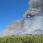
Wildfire is a natural force shaping the landscapes of the western United States. But the neighborhoods, roads, and power lines now woven into these fire-adapted ecosystems were never built with fire in mind. After decades of aggressive fire suppression and worsening drought, the result is a dangerous fuel load that creates ideal conditions for larger, hotter, and more destructive wildfires. While swift and strategic wildfire response is paramount, there is a clear necessity to prepare communities and infrastructure to prevent the damage caused by wildfires before they start.
Proactive communities across the western US are preparing for wildfires by creating publicly-funded management and protection plans like Community Wildfire Protection Plans (CWPPs). Environmental consultants tasked with creating CWPPs explore new approaches to landscape management and wildfire preparedness, especially by utilizing spatial modelling tools.
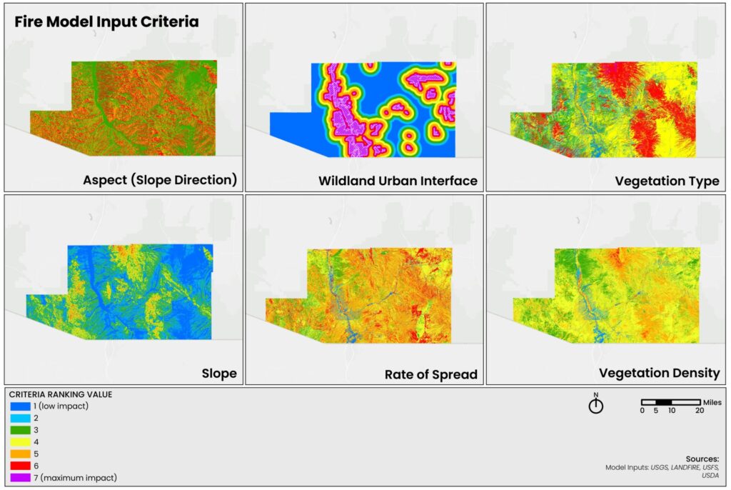
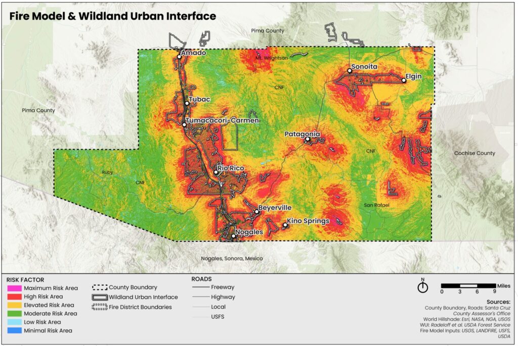
Geographic Information Systems (GIS) is a critical tool in environmental planning, offering complex mapping and modelling capabilities as the basis for well-informed wildfire planning and prevention. GIS enables professionals to quantify and visualize key variables that influence wildfire risk, such as topography, vegetation cover, and plant community composition. By analyzing how these variables interact across a landscape, GIS helps identify areas where wildfire risk is elevated—particularly where multiple risk factors overlap. Additionally, GIS models can incorporate variables of concern to stakeholders, such as proximity to the wildland–urban interface (WUI) , critical infrastructure, or evacuation routes, allowing detailed analysis of potential vulnerabilities.